Connecting Names with Faces and Learning Their Stories

Our archives have hundreds of photographs - professional portraits, and amateur photographs of people, events, and places. As is the case at many historical societies, museums, and archives, we often don’t have the names of the people in the photographs. Sometimes we will have a name but no information about who they were as a person, how they lived, and how they died. In these situations, I often wonder about their lives. What kind of work did they do? What local, national, and world events did they witness or experience? Did they grow up and live their lives here or did they come here as adults? And especially with late 19th-century photographs of children, I wonder if they survived to adulthood. Grim, I know, but the reality was many children died from pneumonia, typhoid fever, scarlet fever, tuberculosis, and influenza; not to mention unfortunate accidents such as drowning.

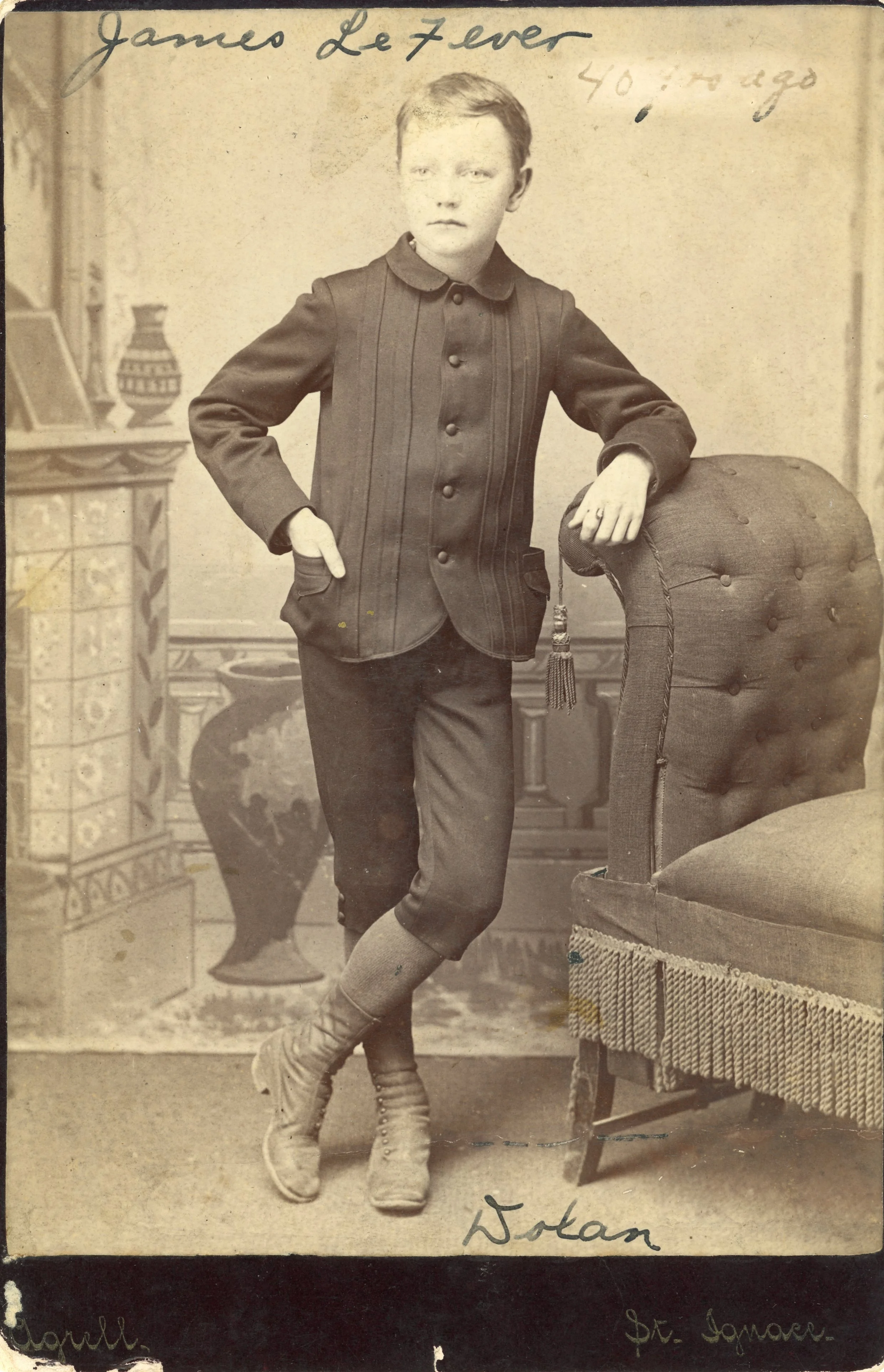
Sometimes, the stars align. Sometimes, like in the picture below, I will have a name on the photograph and the name and place of the studio where the photo was taken. From there, I can use MHS’s Mallett & Walker funeral records, the wonderful resources at the St. Ignace Public Library, and Michigan death certificates to create a more complete picture (if you will excuse the pun) of that person’s life.

James La Fever was born on February 6, 1874. The photograph was taken at Chas. G. Agrell’s studio in St. Ignace around 1884 to 1890. Agrell owned a studio in St. Ignace from 1884 to 1907. James grew up to become a printer, an occupation he worked in until August 15, 1932. His obituary in the St. Ignace Enterprise stated that he was employed at the newspaper offices for many years and a "printer of the old school and one of the best." He lived in St. Ignace for many years before moving to Union City, Michigan just a few years before his death. One week before his death, on October 12, he had surgery to remove stones from his bladder and urinary tract. He was recovering well when he relapsed. He died at 3 A.M. on Wednesday, October 19, 1932, at the Leila Hospital in Battle Creek, Michigan from chronic myocarditis (inflammation of the heart muscle caused by viral, bacterial, or parasitic infections, autoimmune disorders, and some medications, or may have an unknown cause). He was 58 years old. His body arrived in St. Ignace at 9:40 A.M. Friday, October 21, 1932, and was taken directly to Lakeside Cemetery, where he was buried next to his mother. 
  

Erin Vanier, Curator/Collections Manager
The Dunham House and Russell House

The Dunham House was first built by L.H. Dunham and sold around 1885 to James M. Campbell. To the north was the Russell House, formerly called the Everett House. It is unknown when the Dunham House and Everett House were built, however, both are on the 1884 Sanborn map.

After Campbell purchased the Dunham House, the establishment’s popularity grew and in 1890 he built additions to the main building and doubled its capacity to 50 guests. The daily rate was $1.50 and weekly arrangements could be made for regular boarders. St. Ignace and Mackinac County 1895 described the Dunham house as “extremely popular” and recommended it for those “who are seeking a quiet and homelike place of abode.” Unlike many hotels of the time, there was no bar or saloon on the property “to make matters unpleasant.” The Dunham House had an excellent reputation as a first-class management and presenting a variety of food that is well cooked and tastefully served.

To the north was the Russell House, formerly called the Everett House. Sometime between 1884 and 1890, James Russell purchased and renamed the Everett House. By 1895 the business had been sold to William Spice who came from Lansing, Michigan around 1884. The Russell House had 75 rooms, offered lodging, a dining room, a billiard room, and a bar offering a choice of well-selected liquors, wine, and cigars. In the book St. Ignace and Mackinac County 1895, the Russell House was described as “a fine three-story structure of handsome appearance, and from its windows, its balconies, and airy veranda may be enjoyed an extended and lovely view of Mackinac Island and the straits. It furnishes accommodations for 150 guests, and under the careful supervision of Landlord Spice, the comfort of each individual…is assiduously attended to. The cuisine at the Russel is unexcelled [with] amply supplied and exquisitely served tables…the rooms are large and airy.”

Between 1901 and 1907, the Russell House came under the management of Bruno LeClerc who changed its name to the LeClerc Hotel. In 1912, J.M. Campbell sold the Dunham House to C.H. Stannus. Soon after he transferred the house to O.P. Welch and Valentine Hemm who, at that time owned the LeClerc. The Dunham House and LeClerc Hotel merged in 1921 and became the Northern Hotel.

By the 1950s the hotel had been renamed the Nicolet. The southern portion which was previously the Dunham House was destroyed by fire.

Sanborn Fire Insurance Maps

Sanborn Fire Insurance Maps get their name from surveyor Daniel Alfred (D.A.) Sanborn, who founded the Sanborn Map Company in 1867. After the Civil War, there was an increased demand for the fire insurance mapping because of huge population growths and urbanization resulting from factors such as railroad construction, the Second Industrial Revolution, the Homestead Act, and immigration to the U.S. The company’s system of standardized mapping quickly led Sanborn to becoming the largest map company in America. 

Sanborn maps primarily focused on business districts, although occasionally residential areas were mapped. Uniform and detailed information about each building was required for an accurate risk assessment. The maps detail the function of each building, its dimensions, and building composition. Sanborn maps also included business names, street names, railroads, property boundaries, and locations of fire hydrants. Because of the detail in the maps, they are an excellent resource for genealogists, historians, researchers, architects, historic preservationists, and demographers. Sanborn maps of St. Ignace dating from 1884 to 1907 are available on the Library of Congress website.